



**How Wialon Executed a Live Fleet IoT Stress Test in the Saudi Arabian Desert**
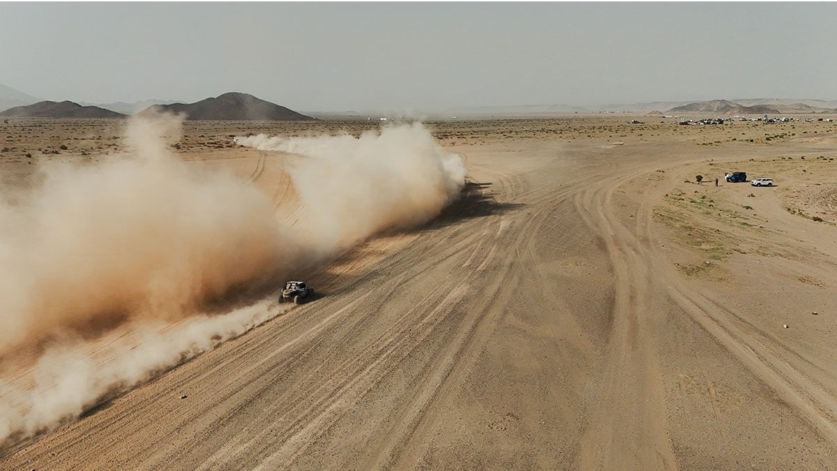
In one of the most demanding real-world environments possible, Wialon recently transformed a Dakar-inspired off-road rally into a live stress test for its fleet IoT infrastructure. The event served as a practical demonstration of how modern fleet platforms can maintain resilient, real-time operations across extreme terrain, unreliable connectivity, and complex multi-tenant systems.
### A Real-World Operational Test, Not a Simulation
Last January 2026, Wialon deployed its fleet management platform during a multi-day off-road challenge across the Saudi Arabian desert. Inspired by the legendary Dakar Rally—an endurance event known for its remote and hazardous conditions—the exercise was designed as a full-stack operational test rather than a simulation or demonstration.
The goal was to validate whether a fleet IoT platform could handle continuous operations under conditions of intermittent connectivity, high vibration, and the absence of fixed infrastructure—all while supporting multiple teams and data streams.
### Hybrid Connectivity: GSM and Satellite in One System
Central to the deployment was a hybrid telemetry architecture designed to maintain visibility across varying network conditions:
– **GSM-based tracking** was handled by Teltonika FMC800 and FTC880 devices, which performed reliably under normal network conditions.
– **Satellite connectivity** was provided by Garmin inReach Mini 2 devices, ensuring coverage in areas where cellular signals were unavailable.
– **Mobile tracking via software** was enabled through WiaTag, Wialon’s mobile tracking application, adding a third redundancy layer.
– **Onomondo SIM cards** supported international roaming and cross-border consistency.
This three-layer connectivity model ensured continuous data flow even as teams moved through areas with fluctuating network quality.
### Field Setup and Real-World Configuration Challenges
Device provisioning reflected real fleet onboarding complexities. All tracking devices were registered in Wialon before deployment, but device IDs were intentionally mismatched with organizational accounts. This required on-site corrections, simulating common scenarios such as asset migration, misassignment, or reconfiguration.
Each vehicle was configured as a distinct fleet object, with data streams validated under live conditions. Transmission intervals were adjusted based on mission intensity, and GPS filtering was applied to reduce drift caused by desert terrain. Despite limited infrastructure and distributed installation efforts, all devices were brought online within approximately 45 minutes.
### Multi-Tenant Architecture for Scalable Access Control
The system operated under a hierarchical, multi-tenant account structure:
– A top-level **Mission Control** account provided full visibility across all teams and vehicles.
– Individual **team accounts** operated with restricted access to their own assets.
– An **organiser account** managed oversight and competition-related tasks.
This setup mirrored standard SaaS fleet deployments, where different stakeholders require varying levels of access to the same underlying telemetry infrastructure while maintaining data segmentation.
### Geofencing as a Programmable Event Layer
Geofencing played a critical role in converting location data into actionable events:
– **Timed missions** required vehicles to enter specific zones within defined windows, with scoring calculated in real time based on entry timestamps.
– **Navigation-based tasks** used geofences as digital checkpoints, replacing traditional addressing and enabling automated route verification.
– **Access control** was dynamically managed through geofence grouping, allowing multiple operational zones to be enabled or restricted instantly across teams.
### Real-Time Tracking and Simulated Recovery Operations
The platform also supported advanced operational scenarios, including a simulated stolen vehicle recovery (SVR) exercise:
– One vehicle was given a time advantage, while another tracked and intercepted it using live telemetry.
– The system managed real-time position updates, role-based visibility, and geofence-defined operational zones.
– Relative movement between vehicles was monitored using interposition logic, a feature commonly used in logistics to maintain precise spacing between assets.
### API-Driven Integration with External Systems
A key extension of the deployment was Wialon’s API integration with external platforms:
– Event data such as geofence entries and speed violations were routed in real time to messaging tools like **Telegram** and satellite messaging devices.
– Python-based scripts dynamically generated integration workflows, enabling rapid deployment of new notification rules without development cycles.
– This demonstrated Wialon’s flexibility as an API-first platform capable of supporting ad-hoc integrations in field conditions.
### Optimizing Telemetry in Challenging Conditions
Desert terrain introduced predictable challenges for GPS stability and signal continuity. To address this:
– Transmission frequency was adjusted dynamically based on mission needs.
– Filtering mechanisms removed low-confidence position data and reduced GPS drift.
– In high-precision scenarios, devices transmitted data at one-second intervals to improve spatial resolution.
### Automated Reporting and Scoring
Wialon’s reporting engine powered the challenge’s scoring system:
– Predefined report templates were executed on schedule, generating daily summaries across distance, speed compliance, and route efficiency.
– Reports were distributed automatically to organizers, eliminating manual processing and ensuring scoring consistency.
– The system effectively functioned as an automated evaluation layer built directly on live fleet telemetry.
### Scale and System Performance
Over the course of the challenge:
– The platform processed tens of thousands of GSM telemetry messages alongside continuous satellite updates.
– Event-based notifications from geofences and API-defined logic supplemented these data streams.
– The result was a continuous, multi-source data environment combining high-frequency positioning with structured event data.
### Remote Configuration and Dynamic Control
During specific missions, devices were reconfigured in the field using Wialon’s Configurator tool:
– Parameters such as transmission frequency were adjusted remotely in response to mission requirements.
– In one example, update intervals were reduced to one-second frequency during a GPS mapping exercise to improve route accuracy.
– This demonstrated the platform’s ability to adapt device behavior in real time without physical access to hardware.
### Conclusion: Fleet IoT as Programmable Infrastructure
The Dakar Challenge was more than a partner exercise—it was a live deployment of a multi-layer IoT fleet management system operating under extreme environmental constraints. The implementation combined hybrid connectivity, event-driven geofencing, API-based automation, and multi-tenant design into a single operational framework.
While framed as a partner challenge, the technical execution closely reflected real-world fleet deployments in logistics, security, and remote asset management. The results demonstrated that modern fleet IoT platforms are evolving beyond passive tracking into programmable infrastructure layers capable of supporting complex operational logic in real time—even in environments with limited connectivity and extreme physical conditions.
*Written by: Darya Chumak, Head of Partner Success Team Americas at Wialon. Chumak has been part of the Wialon team for over six years, supporting the company’s partners across Europe, Africa, the Middle East, and the Americas. She is based in Dubai, UAE.*
—
**Original Article Source:**
IoT Insider. (2026, July 13). *In the Saudi Arabian desert, Wialon transformed a Dakar-inspired off-road challenge into a live stress test for fleet IoT infrastructure*. Retrieved from https://www.iotinsider.com/wp-content/uploads/2026/07/73-iot-deployment-dakar-rally-saudi-arabia/
